Showing posts with label Lake Hoare. Show all posts

Wednesday, January 4, 2012

Overnight Camping at Lake Hoare

On Monday afternoon, Byron, Zach, and I flew out to Lake Hoare field camp to spend the night there. We didn't really need to spend the night in the field but we wanted to have some fun by going on a hike and eating a good meal in a change of scenery from McMurdo. Lake Hoare camp is the home base for the Dry Valleys scientists because it is a central location and there is a camp manager who stays there all summer. The other camps are more "fend-for-yourself" using the available facilities than Lake Hoare.

Camping at Lake Hoare is pretty nice. In fact, I don't know if it's really accurate to call it camping! There's power, wireless internet, a phone, hot meals cooked by the camp staff (there were 2 staff at the camp when I visited), and the tents are already set up. We had some really good steak, homemade bread, baked vegetables, and a salad for dinner, with some chocolate macadamia nut cookies for dessert. It was better than the cafeteria food! The field camp has a main building, 3 labs, bathrooms (well, outhouses), a helipad, and a few other buildings. The camp is on the north side of Lake Hoare right next to the Canada Glacier.
Three lab buildings, DLH pond, two of many tents around camp (mine is the one on the right) and Canada Glacier in the background

The buildings (from left to right): 3 labs, the main field camp, and a cluster of bathrooms, generator, and fuel cache. You can also see a mountain tent and a Scott tent, part of Lake Hoare, the Kukri Hills on the left, and the Matterhorn on the right

Main field camp building

One of the jokes is that I am supposed to pronounce the name of the lake as "Lake Hoe-are-eh" when I tell my mother about it. (For those of you who aren't my mother: It's pronounced just like the word "whore." The little pond in the middle of camp is called DLH aka Dirty Little Hoare!)

So we got there at about 4 PM then helped move some heavy stuff around. We had dinner then after cleaning up the dishes, we went on a hike up to the top of Canada Glacier. To get there, we walked south along the edge of the glacier. There is a little stream with melted glacier water running along the moraine and glacier edge. There are frequent little waterfalls coming off the glacier as well.  We passed by another seal carcass too. To get onto the glacier, we needed to walk along the edge of the glacier until we reached the marked path free from crevasses. It was actually quite easy to walk onto the glacier. It was just like climbing a small hill except we were wearing ice traction devices on the bottom of our boots called STABILicers. We took some pictures on top then headed back to go to sleep.

One of the little waterfalls coming off the glacier

Byron and I on top of Canada Glacier with the ice falls in the background

Taking a drink from fresh glacier water. It was cold but tasted great!
The next morning, we left to walk across Lake Hoare on the ice to the south side of the lake. The ice was really solid except for the moat around the edges. We were lucky to find a solid spot to walk onto the shore on the south end.

There were two experiments we were supposed to sample. The first one is just a series of 9 Bundt pans going up the mountainside. The pans are supposed to collect wind-borne sediments but they don't collect very much at all. One of the theories is that wind can disperse nematodes, tardigrades, and rotifers, but so far they have only found microbes in the sediment traps. The second experiment, called the Elevational Transect, was much more tedious to sample. There are 3 different locations with 17 different samples collected at each. The experiment is designed to monitor the effect of elevation on the soil ecosystem. It is one of the longest-lasting soil experiments in Taylor Valley, being established back in the 1993-1994 field season. The highest sampling location was quite high up the side of the valley located on a relatively flat bench. We carried those soil samples down in our backpacks then added more soil at the other 2 locations. By the end of the day, all of our gear plus soil samples easily made each of our packs 65 pounds or more. We finished about 1 1/2 hours before our scheduled helo pickup time and then they got a little behind schedule so we sat around freezing for a couple of hours.

Byron (L) and I (R) sampling the lowest of the Elevational Transect locations
One of the Bundt pans. It is designed to catch sediment in the bottom of the pan. The marbles supposedly help trap the sediment. There are much better designs on the market but this is what we have to work with...
Byron and I freezing while waiting for the helo. Matterhorn is obscured by clouds as a storm rolls down Taylor Valley
When we got back to Mactown, the communications link between McMurdo and the U.S. was down so we had no internet or phone access to the States (There are backups like true satellite phones in case of an emergency). Kristen was starting to get a little worried by the time it started working again!

Sunday, January 1, 2012

How we sample

Tomorrow, we're scheduled to go out into the field to do our last sampling for the season. I figured I should explain what we do when we sample.

I took some pictures of Byron collecting a sample at the LTM plots at the south side of Lake Hoare so I'll explain it below the pictures.

The first step is to use a spoon to scrape the very top layer of dirt into an amber vial. This sample is used to measure levels of  chlorophyll A. The measurement tells us how much photosynthesis is occurring in that plot.
Next, we use a small scoop to dig out some of the soil. We try to take the top 10 centimeters of soil which ends up being about 3 scoops. This is the sample that we will end up processing to count nematodes, tardigrades, rotifers, etc. The soil biogeochemists also take a portion of the sample to run their analysis.


Byron wanted to make sure that I got a picture of the whirling action! The bags we use are called Whirl-Paks. We remove the air from the top of the bag then roll the top of the bag down until it is flush against the sample. The last step is to use the built-in twist tie to close the bag.


The finished product! These pictures were taking while sampling the LTM plots at the south side of Lake Hoare. Matterhorn is in the background.
We like to have a minimum of three people for each sampling trip. One person has a map of the plots and directs two samplers to the various plots. The plots are arranged on a grid but none of them are labeled so you need to have a map to figure out the various treatments (Labels don't hold up under the harsh conditions of the Dry Valleys. The LTM plots were actually labeled with metal tags originally but most of the tags are either missing or sandblasted so the engraved words are unrecognizable.). We prelabel all of the vials and bags so that we can get the sampling done quickly in the field.

After we finish sampling, we sometimes have treatments to apply to the plots. You might remember I explained that we water the BEE plots by adding 5.6 liters of water. There are other plots where we add liquid carbon, nitrogen, and phosphorous. I wasn't involved with those plots though because a different team went to those sites.

That's it! The last step is to call the helicopter up to come pick us up and to stick all of the samples in a refrigerator set at 4 degrees Celsius.

Tuesday, December 27, 2011

Second trip to the worm farms at Lake Hoare

Yesterday, we went back to the south side of Lake Hoare to do some more sampling and treatments. Everyone calls the areas where our experiments are set up the "worm farms" because that's where we go to collect our nematodes.

We were doing work at the BEE plots at Lake Hoare. If you remember, I've been to Lake Hoare to sample the LTM and Algae plots and I've been to Lake Fryxell to sample the BEE plots, but this time, we were sampling the BEE plots at Lake Hoare.
BEE plots at Lake Hoare
Near the helipad with the Suess Glacier and Matterhorn in the background

The BEE plots are established at Lake Fryxell, Lake Hoare, and Lake Bonney. Each one has 24 plots and has the exact same treatments applied, so I'll just refer you back to my previous post about what we did to the other BEE plots at F6 (Lake Fryxell).

While we were there, we went down to the edge of Lake Hoare so Zach could sample 3 of his own plots and so we could collect a water sample for a researcher at Colorado State. There is a seal carcass down near the water's edge so I took some pictures of that. Seals occasionally wander up into the Dry Valleys but they don't survive because there's no food for them.
Seal carcass near Lake Hoare

Next to Lake Hoare with the Canada Glacier in the background

We were scheduled to do our work at Lake Hoare and then the helicopter was supposed to come shuttle us to Lake Bonney, but we didn't leave on time yesterday morning because of ice fog. When the weather conditions are just right, a thick fog covers the sea ice. The helicopters won't fly if they can't see the ground so we didn't leave until the afternoon. We're leaving in about an hour to go to Lake Bonney to do the last BEE plots. I'm excited to go there because I haven't visited Lake Bonney yet!

Thursday, December 15, 2011

South side of Lake Hoare

I finally made it to the continent of Antarctica!! McMurdo is on Ross Island so it's not technically on the continent. We just returned to MCM from doing field work on the south side of Lake Hoare of the Taylor Valley. It was a lot of work but beautiful.

Byron and I needed to do yet more training this morning, including Dry Valleys training, so we ended up leaving a little later than expected. We got it done and hurried down to the helipad, which is right next to the Crary Lab.

We left within 30 minutes. The helicopter ride was very smooth, but more importantly, it was absolutely beautiful. It takes about 25 minutes each way to fly to the site we were sampling at. Most of the flight is flying over sea ice in McMurdo Sound. However, once you get to Taylor Valley, you can see towering peaks, ponds, streams, lakes, and glaciers. I apologize for all the pictures below, but I felt that I needed to share the view with the rest of you!

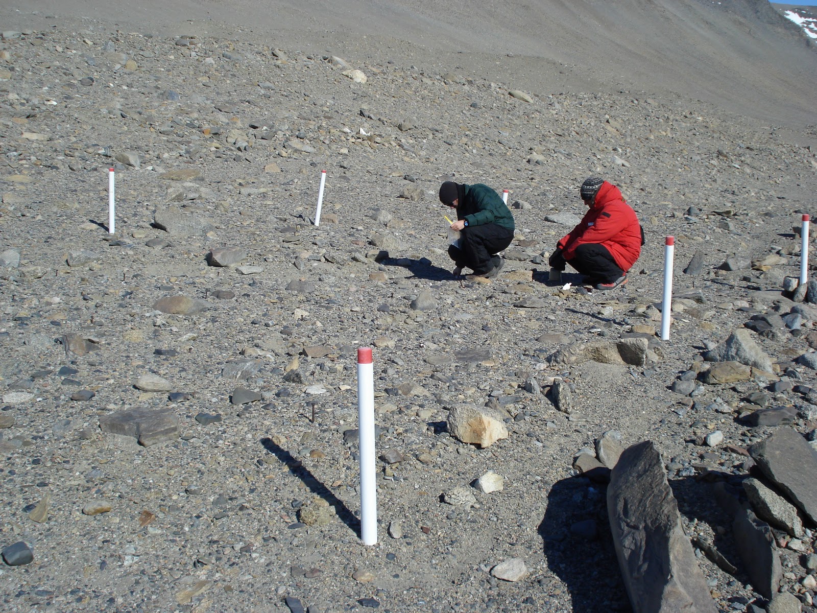
Our sampling was two plots-- the Long Term Monitoring (LTM) plots and the Algae plots. The LTM plots are a collection of 64 little plots with a variety of treatments applied to them. The treatments include adding temperature, adding sugar, adding water, etc. and monitoring how soil ecosystem responds to such changes. They have been sampling these sites since the 1994-1995 season. The Algae plot was a lot smaller-- only 16 plots. The treatment involved distributing dried algae into the dirt to see if that changed the soil ecosystem.

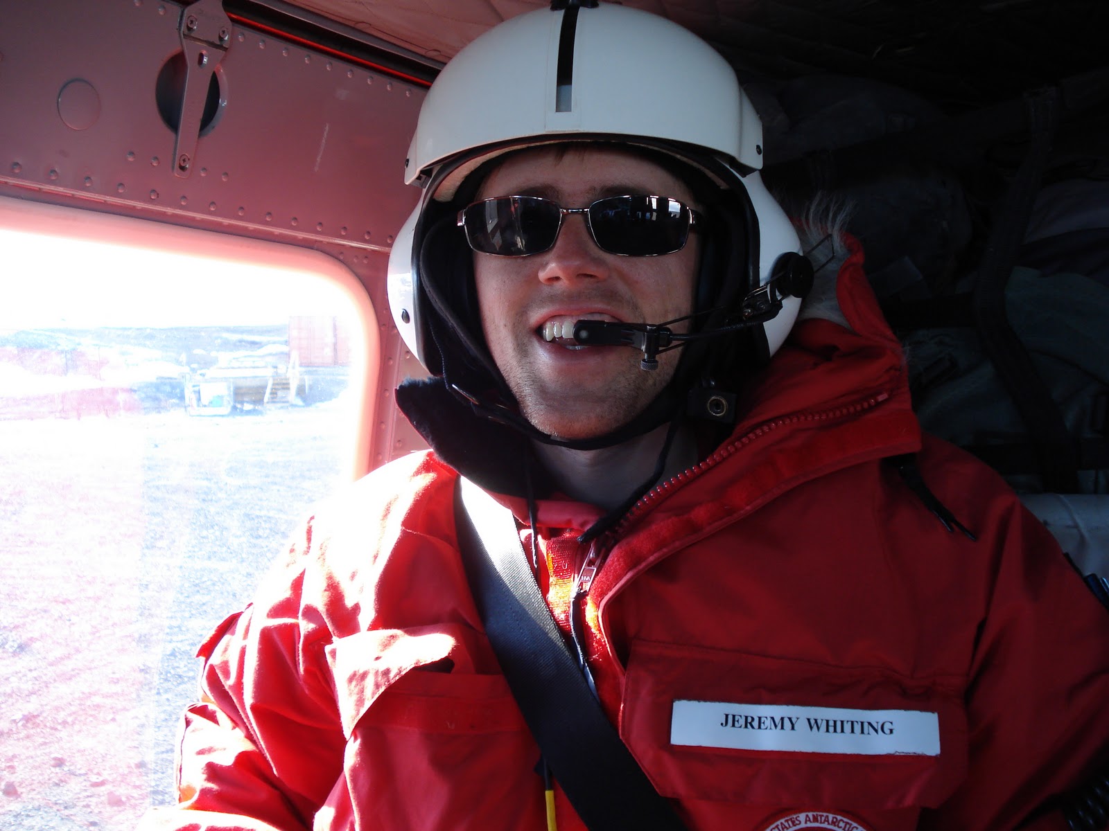
I'm excited for my first Antarctic helo ride

We had an amazing, cloud-free view of the volcano Mt. Erebus on the way

An iceberg trapped in sea ice

Commonwealth Glacier, Taylor Valley

Edge of the Canada Glacier, Taylor Valley

Also the Canada Glacier with Mt. McLennan in the background (I think)
Matterhorn with the Suess Glacier, Taylor Valley

Our ride getting ready to leave

A portion of the LTM plots

Sampling the Algae plots

Our ride picking us up, with Matterhorn and Suess Glacier in background